

DIRECTIONS AND TRAVEL INFORMATION


GEORGETOWN: THOMPSON BOAT CENTER
Practice
Thompson Boat Center in Washington, DC is located next to the Watergate, just off the Rock Creek Parkway at the end of Virginia Avenue, NW. Note different directions for rush hour and non-rush hour. Rock Creek Parkway is one-way outbound from 4:00pm to 6:15pm and this would be termed 'rush hour' for our purposes.
Going to (and arriving at) Thompson's before or after evening rush hour (4:00 pm - 6:15 pm, M-F): Cross the Teddy Roosevelt Bridge, staying left. Exit left (toward E St.) and stay left to get onto the E Street Expressway. Again, get into the left lane and follow the signs for the Kennedy Center and Rock Creek Parkway. Turn left, get into the center lane, turn right at the light at Virginia Ave, then immediately get into the left lane. Go STRAIGHT at the light into Thompson's Boat Center across the street.
If going to Thompson's during evening rush hour (4 pm-6:15 pm), cross the Teddy Roosevelt Bridge and take the first RIGHT (Independence Ave). Circle down and around to the right to Rock Creek Parkway and immediately get into the far left lane (lane direction changes during evening rush hour). Continue to light at Thompson's where you make a left turn into the parking lot
Leaving Thompson's Boat Center
Leaving the park: During rush hour (4 pm - 6:15 pm) you must turn left and exit onto P Street and go through Georgetown.
At all other times you may exit straight out of park onto Virginia Ave. and make an immediate left to get onto the E Street Expressway, Roosevelt Bridge (right lane) and I-66 or GW Parkway. This is the fastest route home, making exiting the park at 6:15 pm advisable.
Regattas at Thompson's Boat Center
There is a parking lot, but it is limited and preference is given to busses, trailers, staff, and volunteers, all of whom arrive early. There is commercial parking by the water, close to the finish line off Wisconsin Avenue under the Whitehurst Freeway. There is easy access by foot from that lot to the finish line and to Regatta headquarters.
To Commercial Parking at Wisconsin Avenue
Follow Wisconsin Avenue south to K St, NW, also known at that point as Water Street. Here commercial parking is found in the buildings on the north side of Water St. If you are proceeding to the Thompson parking lot, turn left on K (Water) St and proceed east through several stop signs, moving into the right hand lane. As K St begins to climb up hill ahead of you, on the right you will see a small underpass. Follow this onto Rock Creek Parkway and take an immediate right into Thompson Parking lot.


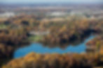
Click the photo to Enlarge
FAIRFAX STATION: OCCOQUAN - SANDY RUN
Getting to Sandy Run Park - 10450 Van Thompson Road, Fairfax Station, VA 22039
From I-95 South: Take exit 163 (Lorton Road, Route 642) West. After about 1.6 miles (at the top of a hill), bear right on Furnace Road and follow it until it meets Route 123 (Ox Road). Turn right on Ox Road and travel 1.2 miles to Hampton Road where you will turn left. Go about 1/2 mile on Hampton Road and turn left on Van Thompson Road (you will see power lines overhead, just in front of you). After about 1/4 mile Van Thompson bears sharply to the left at a well-weathered barn and continues down a hill to the entrance to Sandy Run Park. Once there, parking officials will direct you to a parking spot. ($20 parking fee)
OR:
From McLean: Travel South on Route 123, Ox Road until you reach Hampton Road. Hampton Road is about 6 miles south of where Braddock Road intersects 123. Turn right onto Hampton Road. Go about 1/2 mile on Hampton Road and then turn left onto Van Thompson Road (you will see power lines overhead, just in front of you). After about 1/4 mile Van Thompson Road bear sharply to the left at a barn and continue down a hill to the entrance to Sandy Run Park.
Parking within Sandy Run Park
Plan for additional travel time, both from the off-site parking and within the park. Sandy Run is a superb rowing location, but not user-friendly for large crowds. Please show courtesy to each other and especially the volunteer parkers. It is not their fault that the parking lot is full. Come early as the lots fill up quickly. Carpooling highly recommended. Follow @VASRAParking on X (Twitter) for parking updates and notification of when off-site parking is in effect.
Athletes/Volunteers can be dropped off at the 1st lot (Van Thompson) for a free shuttle into the park. You can pick them up here as well. If you want to go past the Van Thompson lot for any reason, you will need to pay the parking fee.
-
Free Rower Drop off is in Van Thompson lot starting at 6:15 AM
-
Free Rower Pick up is in Van Thompson lot until the last race
There may be money collectors at the park entrance ($20 per car). Parking attendants will direct you to the closest available parking. After you have parked and are inside the park, Van Thompson Road continues down a steep hill. The sign-in area for all volunteers, the boathouse, launch area and regatta headquarters is at the end of Van Thompson Road. The MCC Food Tent is usually set up in the back of Parking Lot "A" where the shell trailers are parked and the rigging/derigging occurs, on the left side as your approach the launch area.
-
The $20 parking fee will apply to everyone entering the park without a VASRA issued pass
-
NO REFUNDS WILL BE GIVEN FOR ANY REASON
See Sandy Run Line Map, Sandy Run Aerial Map, Sandy Run Drop Off & South County Parking Map and Sandy Run Trail to Grandstand Map to find specified locations.
Off-Site Parking
Once the on-site parking is full, which usually early in the day, and for all spectator parking, cars will be directed to the off-site parking location at South County High School (8501 Silverbrook Road, Lorton VA) for all regattas except Regional Park (park at the commuter lot at 1325 Old Bridge Rd Woodbridge, VA 22192) and Ted Phoenix (TBD). Parking updates are provided on X (Twitter) #VASRAParking and the club will try to email out as available.
Directions to South County High School Parking Lot: From Sandy Run, head northeast on Van Thompson Rd, then turn right onto VA-647. Turn right onto VA-123 S/Ox Rd and then use the left lane to turn left onto Lorton Rd. Turn left onto Hooes Rd and then turn right onto Laurel Crest Dr to enter the high school.
At the Sandy Run Park
There are three routes to the Sandy Run Finish Line from the park areas:
-
by shuttle bus ($5 per person) which leaves from the upper Parking Lot "C" (5 minute ride)
-
by foot on the path from the Parking Lot "C" (1/2 mile on a winding and hilly path)
-
by foot on the path from the boathouse (3/4 mile on a winding and hilly path - about a 20 minute walk)
At the grandstand by the finish line there is a semi-covered, concrete viewing area, a concession stand and bathroom facilities.
TOWNSEND, DE: ST. ANDREWS
Getting to St. Andrews
Visitor's should use the GPS address for Rodney Point 560 Noxontown Road, Townsend DE 19734 and follow the crew signs past the official school entrance to the visitor's pavilion on the other side of the lake. Certain models of GPS units and some phone applications misplace St. Andrew's. If you think your GPS app may be in error, an alternative address to find St. Andrew's is: 350 Noxontown Road, Townsend, DE 19734.
Visiting crew teams: follow the relevant directions below, but instead of entering campus through the stone pillars, instead proceed on Noxontown Road, around the curve and over the small bridge. Use the second entrance on the right to turn into the gated Rodney Point Picnic Grounds.
From Washington, DC
Go east on Route 50 over the Bay Bridge until it intersects with Rte. 301. (Middletown is approximately one hour from the Bay Bridge). Continue on 301 North into Delaware. One half mile past the 301 Hess Truck Stop you will come to a traffic light with a Lowes on the right; turn right at the light onto Rte. 299 East. Continue on Rte. 299 through the center of Middletown. At the fourth light take a right onto Silver Lake Road. Proceed until it ends at Noxontown Road. Cross Noxontown Road and enter through the stone pillars. Park in the circle in front of Founders Hall.
From Baltimore and Points South
Take I-95 North to the Delaware state line. About one mile after tollbooth, exit onto Route 896 South; continue on Rte. 896 for 10 miles, until you come to a traffic light where the road becomes Rte. 301/71. (Do not turn left where sign points 896 to Rte. 13.) Continue through the traffic light for three miles to the next light. Immediately after Dunkin Donuts bear to the left. Go left across railroad tracks until you reach the third traffic light in the center of town. Turn left onto Main Street (Rte. 299 East). At the third light take a right onto Silver Lake Road. Proceed until it ends at Noxontown Road. Cross Noxontown Road and enter through the stone pillars. Park in the circle in front of Founders Hall.


PHILADELPHIA, PA: SCHUYLKILL RIVER
Getting to the Schuylkill River
From Washington, DC, Baltimore, Wilmington:
-
Take I-95 North through Wilmington to Philadelphia International Airport and follow signs for Phila Center City via Route I-76 or Schuylkill Expressway
-
Take exit, I-76, Schuylkill Expressway, west. This takes you across the Penrose Ave. Bridge across Schuylkill, a.k.a. Route 291.
-
As soon as you come down bridge get in left lane, as you will turn left at first light onto 26th Street.
-
This will take you directly onto I-76 west. Follow I-76 about 8 miles, past Boathouse Row and the race course.
-
Follow I-76 West to exit 340 on the right.
-
Take this exit, turn right at foot of exit and get in the left lane as you go over City Avenue Bridge across the Schuylkill River.
-
Stay left and follow signs for Kelly Drive.
-
The ramp will spiral downwards in a counter-clockwise direction and will merge you onto Kelly Drive, southbound. Be very careful, especially if you are pulling a boat trailer on this tight, descending curve!
-
Move to right lane of Kelly Drive after merging at the bottom of the spiral.
-
Take Kelly Drive past four traffic lights.
-
The first building on the right, between the river and Kelly Drive, is the Canoe Club, where all out-of-town crews launch, except for Dad Vails or Stotesbury.
-
Take a right into the parking lot, except for Dad Vails or Stotesbury.
-
For Dad Vails or Stotesbury, continue another 3/4 mile to the Athlete’s Village near the Three Angels.
-
OR, continue two miles on Kelly Drive to Boathouse Row and Regatta Headquarters at #4 Boathouse Row.
Traffic and Parking Regulations
Traffic movement is in a one-way direction from the entrance to the exit beyond the grandstands. Please do not attempt to park on Kelly Drive until it is closed by police. Reduced speed is in effect on the drive once past the entrance. We have pedestrians, rowers carrying boats and cyclists so please drive carefully.
PLEASE:
-
Be patient, respectful and courteous. You are going to a rowing race and a cookout, not the emergency room.
-
Be considerate and respectful of your neighbors. We all need to set a good example for our kids.
-
Schools that violate the temporary police regulation traffic control will be sanctioned BY PSRA.
Handicapped Parking
Spaces are reserved for those cars with handicapped tags near the Grandstands. A handicapped vehicle must have BOTH a PSRA parking pass and a handicap tag to enter the Drive.
Off-Site Parking for Spectators
Remote parking lots will be available on both Saturday and Sunday (see the maps above). Shuttle buses will run from 8 am to 6 pm. The lots in Fairmount Park can be reached by following the Kelly Drive detour. Monitored parking will cost $20 per day. Shuttles are anticipated to run every 20-35 minutes (depending on traffic). The bus drivers are instructed to stop for drop off/pick-up whenever requested – so be sure to know where the tent is located by referring to the information provided on the regatta information page.